Google · XUpdated Original · English

Google Earth AI can bridge critical gaps across diverse geographies, diseases, and areas of public health using autonomous predictions and…

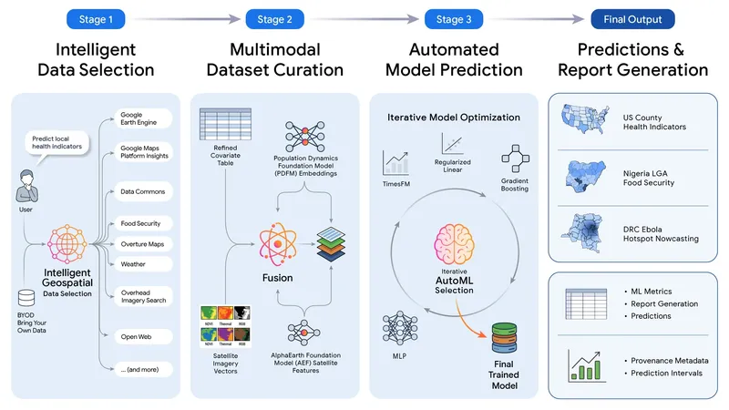
A diagram illustrating a four-stage process for generating predictions and reports using intelligent data selection, multimodal dataset curation, automated model prediction with iterative AutoML optimization, and final output generation.
Image source · Google · X

Google Earth AI can bridge critical gaps across diverse geographies, diseases, and areas of public health using autonomous predictions and population dynamics.

The system combines environmental signals and other data sources with AlphaEarth Foundations and our Population Dynamics Foundation Model (PDFM), and a prototype Geospatial Reasoning agent.

In plain language, researchers ask questions like where a disease is likely to spread next, and the AI automatically gathers relevant models and datasets to build an accurate prediction model.

By combining satellite views with population patterns, the tool reveals hidden risk factors, helping identify issues earlier.
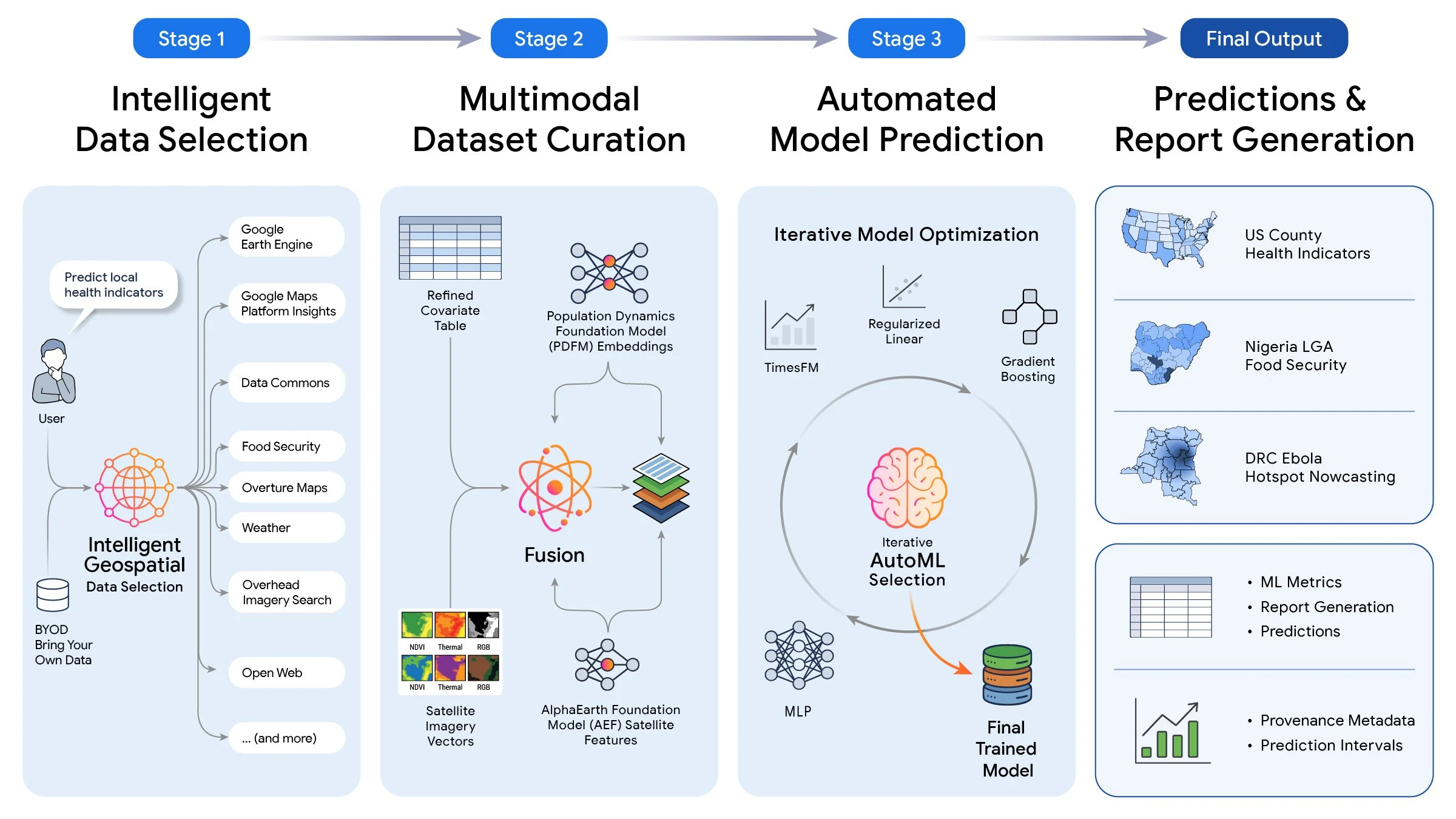
A diagram illustrating a four-stage process for generating predictions and reports using intelligent data selection, multimodal dataset curation, automated model prediction with iterative AutoML optimization, and final output generation.
Original source

Google · X

Content notes

Original publication and rights belong to the source.